
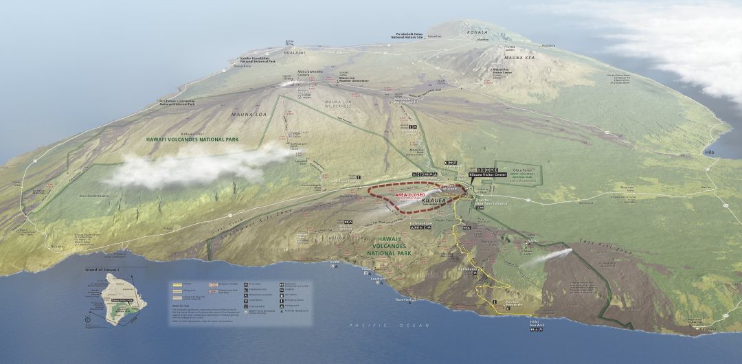
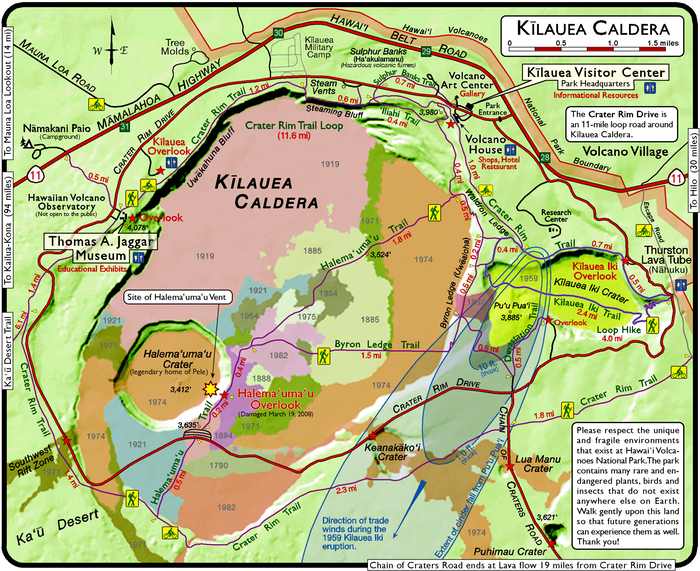
The big island of Hawaii has been all over the news throughout the past few weeks as the lava continues to spew out of the cracks in the crust in the southeastern region of the island, in particular the Puna District, along the East Rift Zone. Kilauea continues to spew a gigantic ash cloud soaring up to 30,000 feet. An up to date map provided by the USGS can be found here. I actually started drafting this post before Kilauea started threatening homes, as it was the main national park that I visited before Joshua Tree National Park. My heart goes out to those affected by the lava and incessant earthquakes across the island today. And I’ll spend sometime speaking of the Hawaii Volcanoes National Park that I got to know, before the recent eruptions and during much quieter times. I’ll also add that at the time of this writing, about two-thirds of the park is closed due to earthquakes, summit deflation, and potential steam explosion at the summit of the Kilauea summit; you should definitely check out the park’s website for current conditions.
I had never been to the big island of Hawaii before. So when I got the chance to buy one get one free airline ticket, I thought, hey let’s go to Hawaii. What made the deal even sweeter was one of my best friends moved there a couple of years ago and the period to travel with the deal included her birthday (late February). So I got tickets flying directly from SFO to Kona.
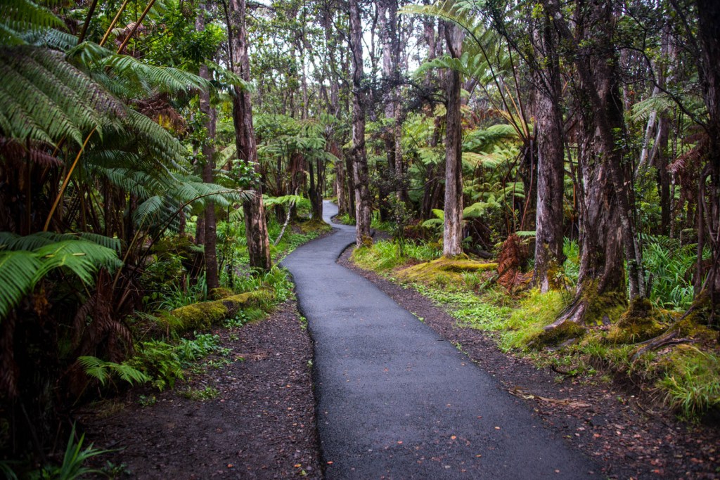
We did the tourist thing and got a stock 4×4 Jeep Wrangler. It fulfilled my dream of pretending to be featured in Jurassic Park while driving through the rain forests of the beautiful island. We drove from the dry Kona side to the wet Hilo side through the Saddle Road. I’ll have to touch on that part of the trip at another time, and for this particular adventure I will elaborate on my time spent in Hawaii Volcanoes National Park where I fulfilled a dream of most geologists… To witness lava erupt from the Earth. Let me preface this and admit that although I did not see molten lava up close, it was still remarkable and amazing what I could see with little effort. It is one of the few parks that really seems to come to life at night, and it’s encouraged to visit at all hours as the park is open 24 hours per day. The island is relatively dark, as the towns use dimmed lights so that views from Mauna Kea Observatory are not obscured as we try to look into other worlds in distant galaxies. The lava really stands out against the dark backdrop of the basalt rock and the lack of light pollution in the skies.
I did not really do any research regarding the park, and decided to just wing it on this vacation. I knew we were going to be staying in the wet Hilo side of the island, but I did not anticipate for it to rain the entire time that we were there. It made hiking a matter of chance as to whether we remained relatively dry or got completely drenched in downpours. Why does the Big Island have a wet and a dry side of the island?
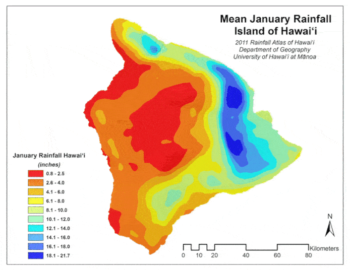
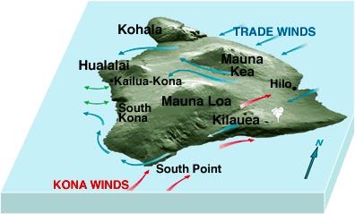
It turns out that each island of Hawaii has a wet and dry side that is caused by what’s known as trade winds. Trade winds are stable and predictable winds that are cool in temperature and moist as they blow from high-pressure zones in the North Pacific onto Hawaii’s eastern and northeastern landmass. As the wind hits the mountains/volcanoes, the air rises and chills in the cool, high-altitude temperatures. Moisture condenses and produces clouds and rain or snow on the upwind/windward (the side from which the wind comes from) slopes. Thus, rain mostly falls on the elevated upwind/windward side of the islands (aka Hilo side of the big island). The air that crests the mountaintop warms and dries as it heads down the leeward slopes, leaving them dry and making vegetation sparse [1]. This creates a rain-shadow on the western slopes, away from the prevailing winds (aka Kona side of the big island).
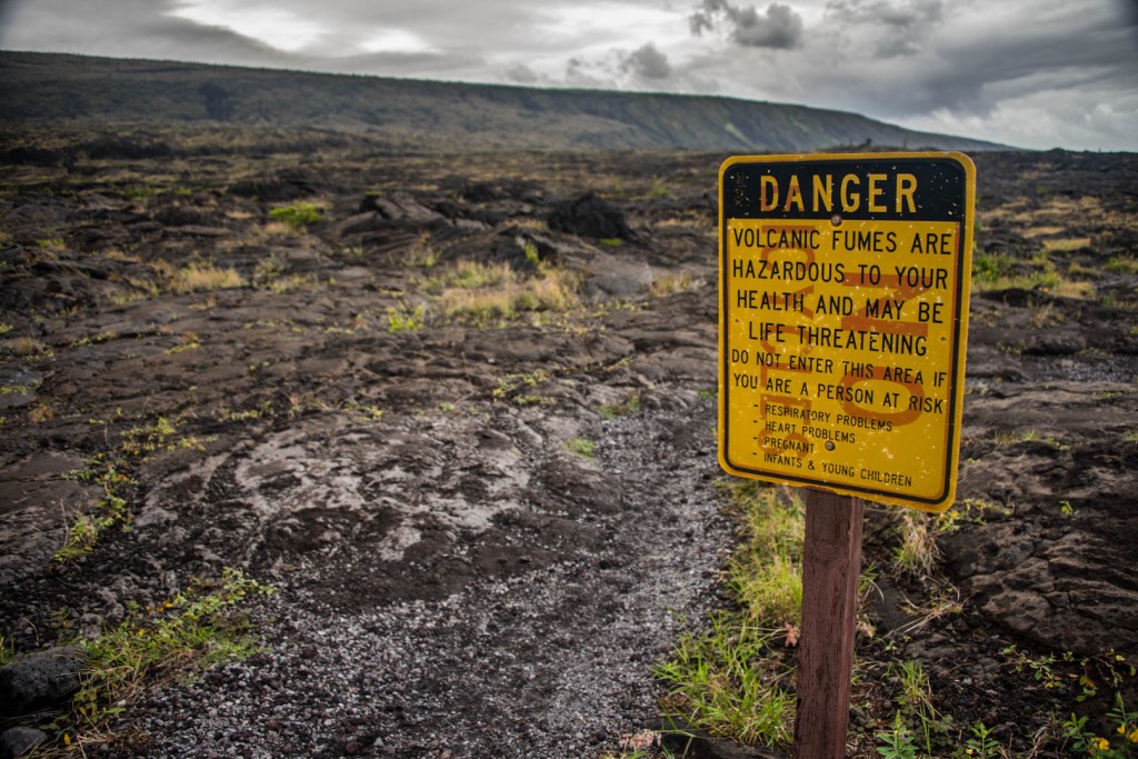
The winds not only have an effect on climate, but it also can directly affect air quality. Kilauea is producing a nearly constant stream of volcanic smog, also known as vog. Vog is a visible haze that is created with sulfur dioxide and other volcanic gases combine and interact with oxygen, moisture, dust, and sunlight over periods of minutes to days. The aerosol in vog is comprised primarily of sulfuric acid and other sulfate compounds, but small amounts of toxic metals have been detected. Close to Kilauea sulfur dioxide gas is the major component of vog, but far away from the volcano such as the Kona coast on the dry west side of the island, aerosol particles dominate vog. Much is still unknown about the composition and subsequent health effects of vog and other forms of volcanic air pollution [2].
Volcanic gasses can prove detrimental or even deadly to visitors and locals if they’re caught in the wrong place at the wrong time. Just a few weeks prior to our arrival, an experienced tour guide who knew the volcano and lava field better than most died from noxious steam created by a sudden downpour over the lava. This combined with the super rainy weather and ~14 miles round trip trek across jagged basalt fields made a close encounter with the lava low on the priority list of things to do during this trip.
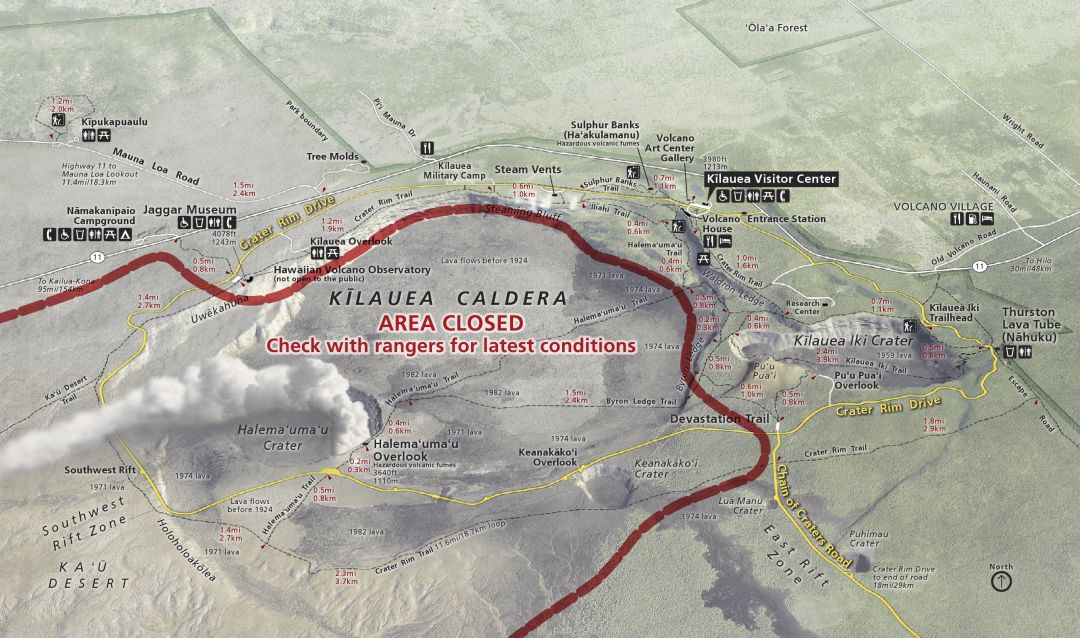
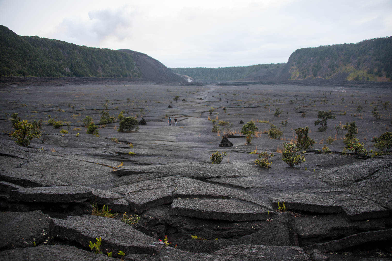
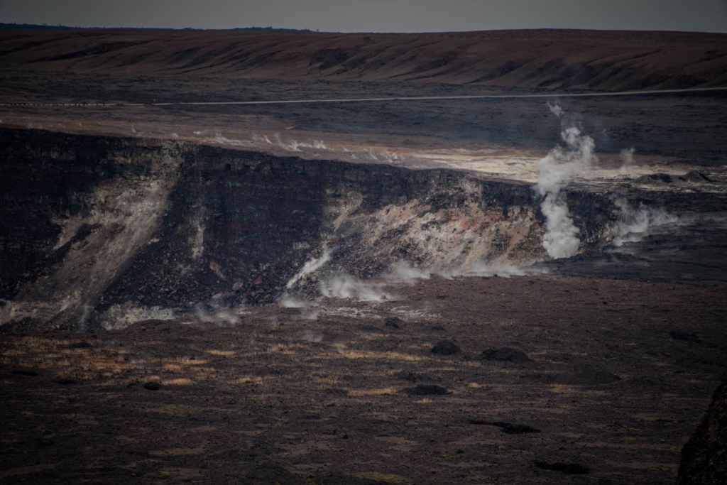
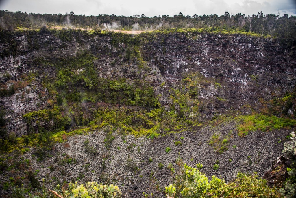
The first day we visited the park, we toured with my friend who now calls Hawaii home. She led us on the most popular hike in the park, the Kilauea Iki Crater, around sunset. The Kilauea Iki Crater was once a molten lake of lava that had a dramatic eruption in 1959. The trail starts on the rim of the crater, with amazing views of the crater with Kilauea steam in the distance, at Halema’uma’u Crater. People walking along the trail in the crater resemble insects.

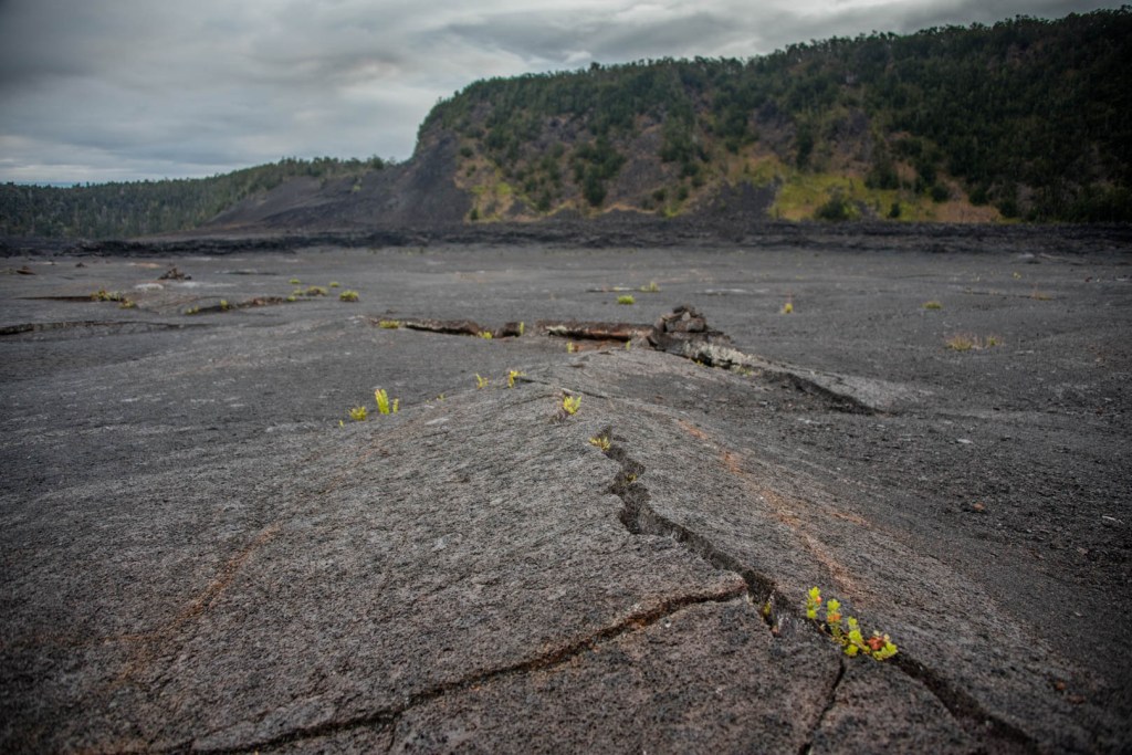
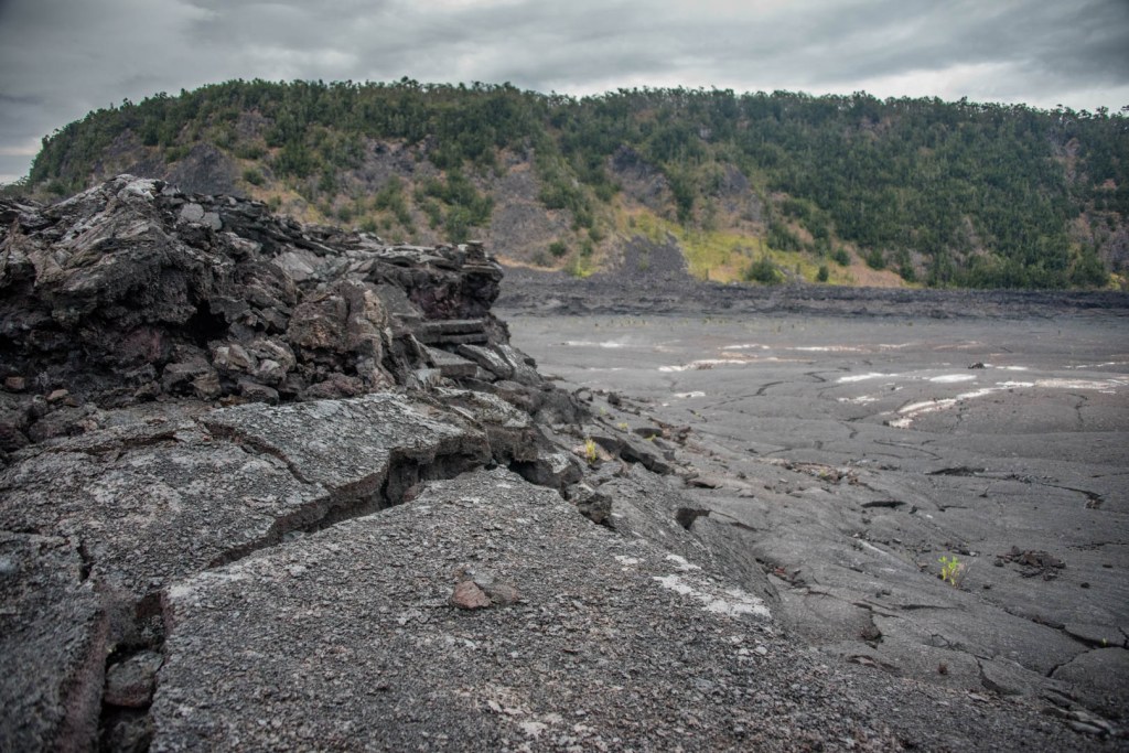
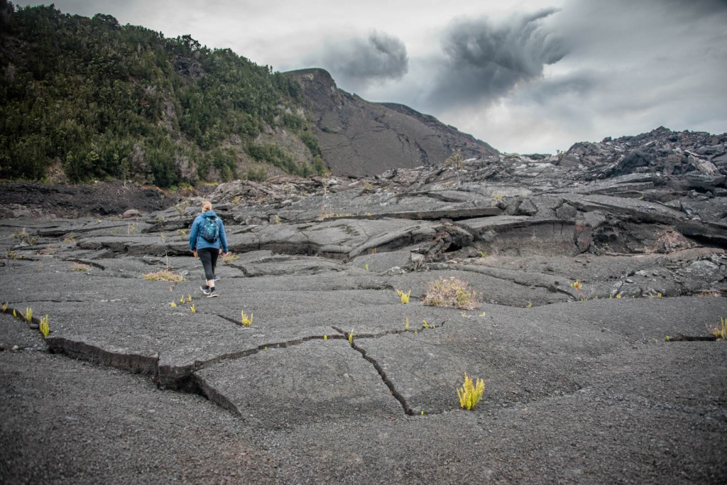
After descending through the dripping rain-forest jungle, you are greeted with a nearly barren landscape that some compare to that of Mars. I say nearly barren because life is finding its way as plants reach their roots inside the cracks of the dried lava lake.

After reaching this little hill inside of the crater, we turned around, not knowing that the trail makes a loop. Our now local tour guide was not aware of the loop either… another thing to check out the next time I visit. As we headed back on the trail the way we came, it began to get dark and the volcano really seemed to come to life as the orange glow illuminated the vog in the distance. We made our way back to the lodge, the Volcano House, and splurged on a birthday dinner for my dear friend. We got a table right by the window where you could see the orange glow while eating. The food was okay, but the views were incredible.
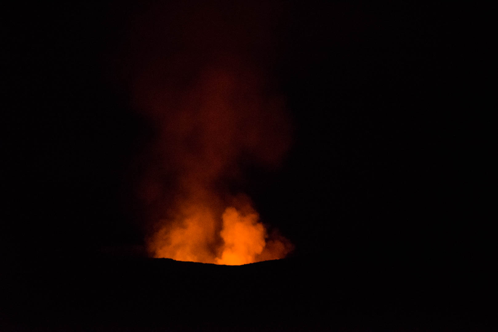
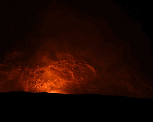
Once our bellies were full we got to enjoy the park after dark. The park is open 24 hours per day and it is quite active at night, as the view of the lava really comes to life in the darkness. We headed toward the Jaggar Museum to check out the viewpoint overlooking the Halema’uma’u Crater, aka the current lava lake that is the source of the firey cloud of vog.


The lava lake level was so high that you could actually see lava jumping up from the lava lake and you could hear the gurgling as the molten rock splashed into fresh young rock. It was fascinating to sit and watch. There were plenty of people that gathered around in complete awe as we stood around in the darkness, which made the whole experience rather social.
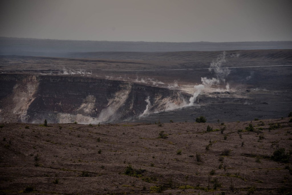
The views of the crater during the day are startling, especially after only seeing it in the middle of the night.
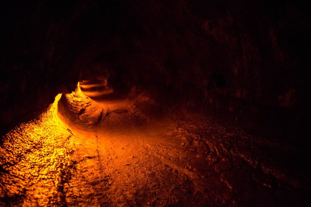
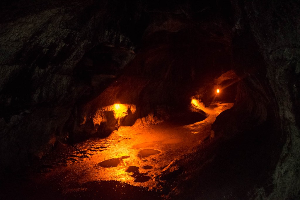
Another park attraction that you shouldn’t miss is the Thurston Lava Tube, also known as Nahaku, along the Crater Rim Drive. Parking is limited but we lucked out with a parking space right away. You walk 1/3 mile through a lush and dense forest to the mouth of the lava tube. It’s astonishing that anyone found it in such a full forest, but Lorrin Thurston, a newspaper publisher, discovered it in 1913. Apparently the roof was covered with lava stalactites (they hang “tite” to the ceiling), but those disappeared as souvenirs [3]. The lava tube is approximately 500 years old and stretches 600 feet long [4]. Lava tubes are created by a flowing river of lava that gradually cools down on the sides/tops and forms a crust. The lava tube provides a conduit for magma to travel, and if it continues to flow unobstructed, it can leave behind the overgrown channel as a tube-like cave. Another way lava tubes are created is when a super-hot magma flows into or under a layer of cooling, slowly flowing lava, thereby boring a tunnel into the existing cooler lava flow [5].
The lava tube is illuminated by these red lights that make you feel like you are part of the lava flow. You can see all sorts of different textures of the crust as lava cooled. There are puddles throughout the tube, as water percolates down through the porous basalt rock.

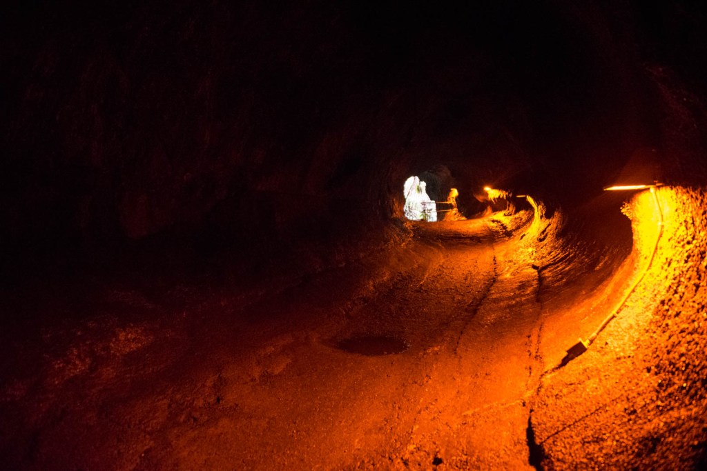
After you walk through the entire tube, another stairway leads you back to the surface. The trail winds through the forest, and it’s hard to believe that you are on top of the lava tube. The little roots observed extending down from the ceiling of the lava tube are given context in the lush and green forest.
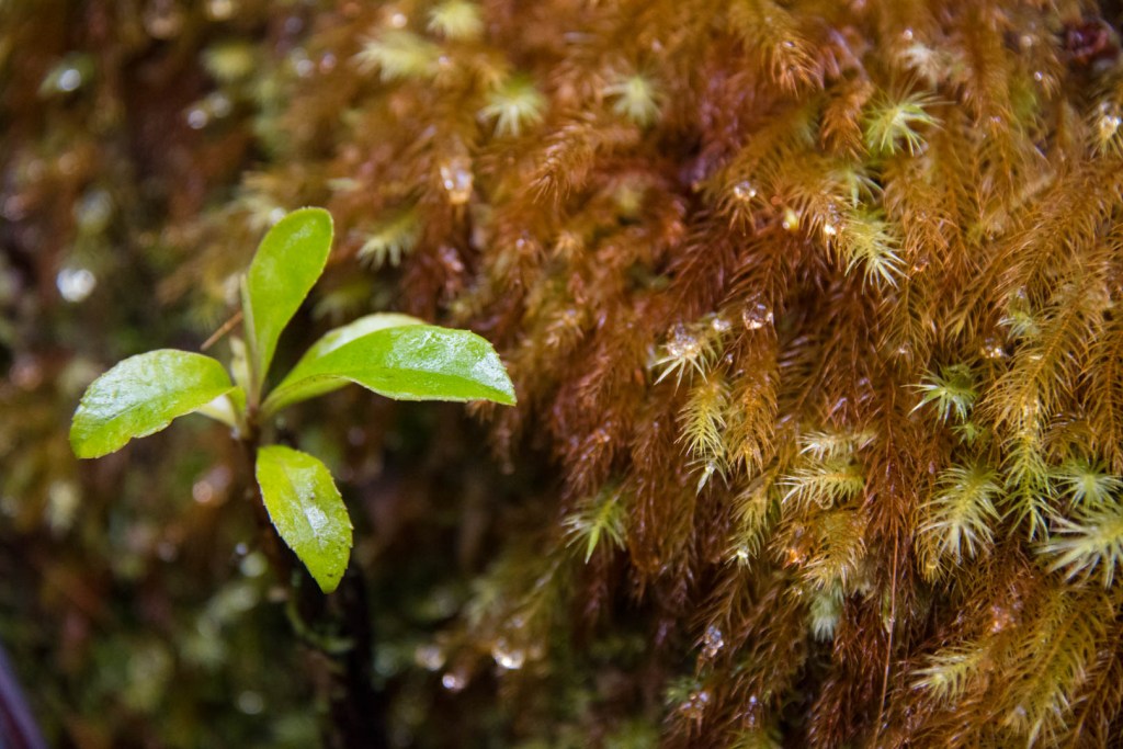
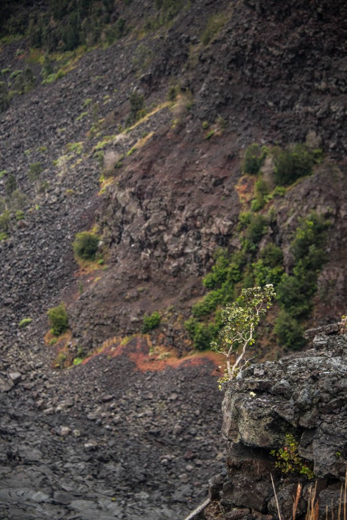
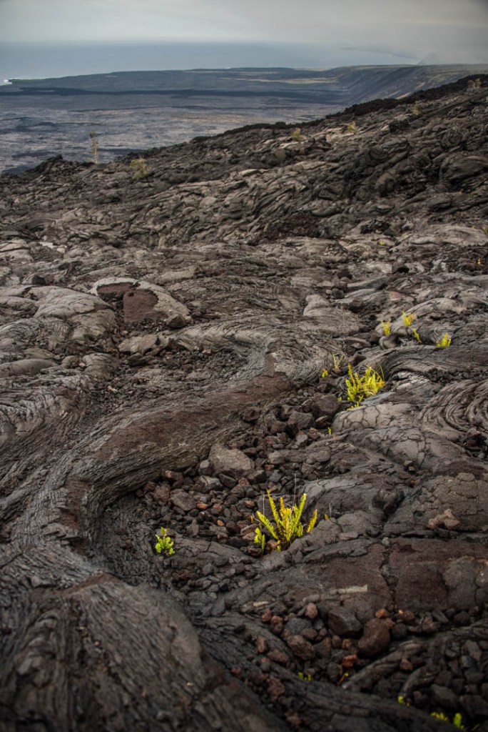
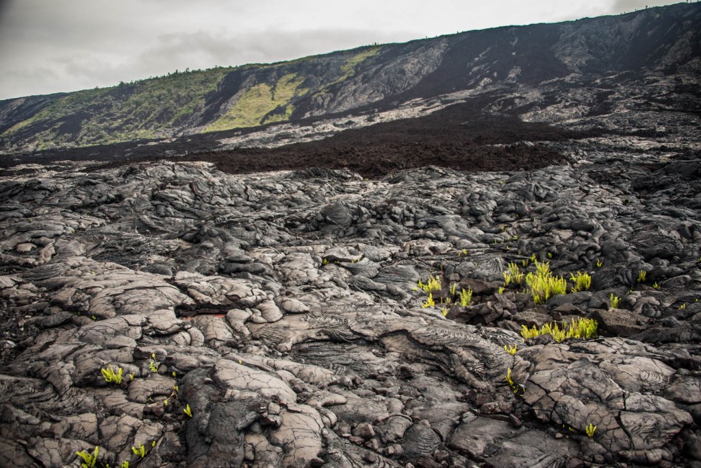
Continuing south along the Crater Rim Drive and then onto Chain of Craters Road, you pass through countless basalt flows/eruptions and crater features. I lost track between all of their names, but each one looked slightly different. I loved watching how the vegetation starts to grow again through all of the cracks, and sometimes it looks like trees are just hanging on by a thread.


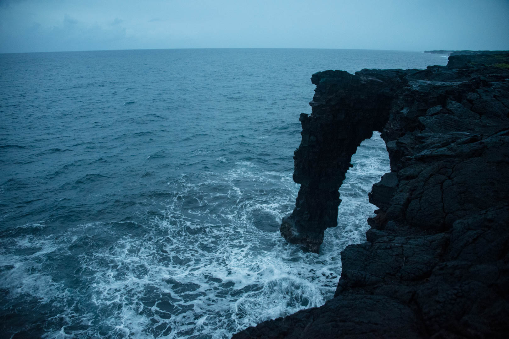
The Chain of Craters Road (formerly known as Crockett’s Trail) was dedicated in 1928, and 18.8 miles to the end where the road is closed due to lava flows. The elevation change is approximately 3,700 feet, which was noticeable and quite dramatic in many places, especially in the Hole’i Pali section. The road begins at its highest part of the east rift zone where frequent rains create a rainforest [6]. You descend into the barren, windy south coast, where the road ends due to lava flows. Since 1986, lava has repeatedly covered parts of the Chain of Craters Road (nearly 9 miles of the road has been inundated by flows). In June 1989, Waha’ula Visitor Center and other adjacent buildings were burnt and covered by lava. In 2003, lava flows extended out to the sea near Holei Sea Arch, and the road was closed [7].

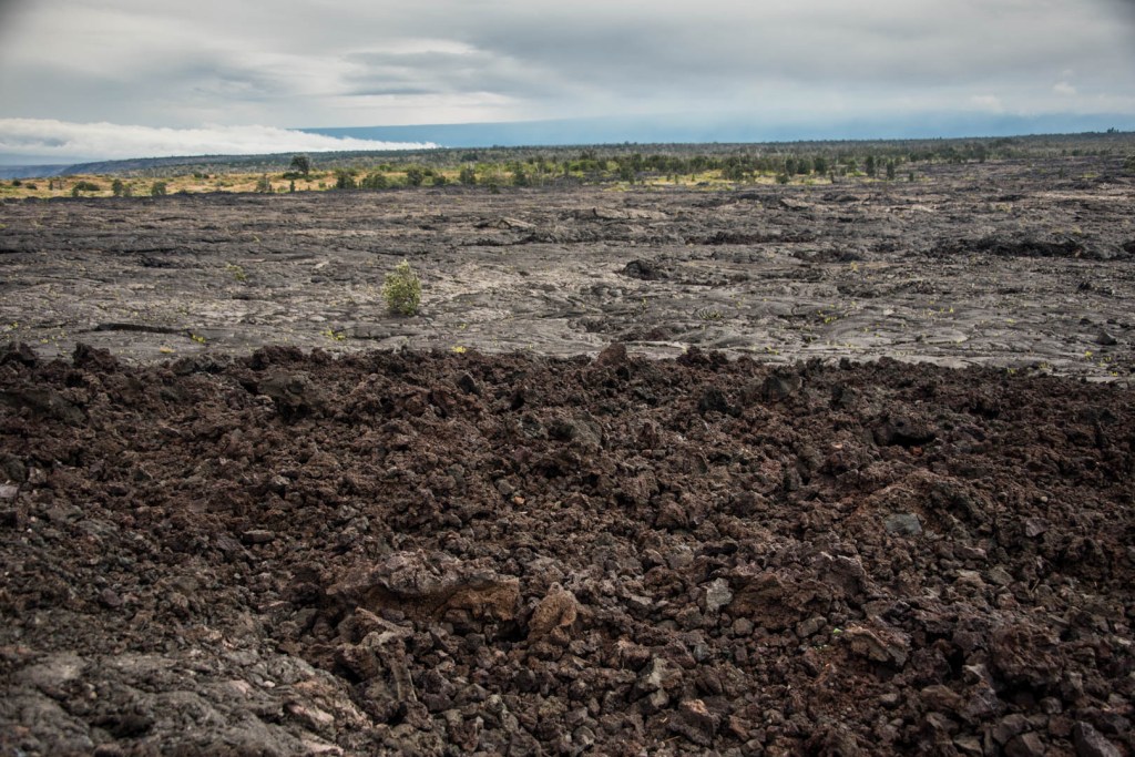
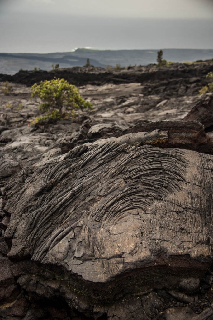
As you drive on this nicely paved road, you are passing through contrasting scenery. Signs along the side of the road identify which flow you’re driving through, and what year that it was born. The two different types of basaltic lava flow seen on land, pahoehoe and a’a are visible throughout the area even without getting out of your vehicle. Pahoehoe lava is smooth and can be ropey whereas a’a is jagged and consists of angular fragments. I like to remember it by something silly; a’a makes you say, “ahh! ahhh!” if you were to walk on it with bare feet. A’a forms when lava flows rapidly and generally on steep slopes with high discharge rates compared to pahoehoe, which is the opposite with lower discharge and gentler slopes.
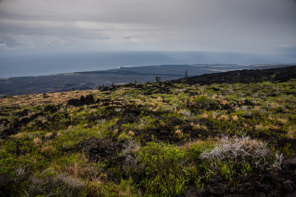


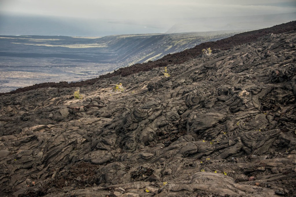
As you start to make almost a u-turn in the road along Hole’i Pali, you are greeted with spectacular views. You can pull along the side of the road and grab epic views of the lava flow leading out to the ocean. The park’s acreage has increased by hundreds of miles due to the extensive volcanic activity. Some of the lava appears red, due to the oxidation that occurs during the flow [8].
While we visited, I think the most photogenic part of the entire park were the Pu’u Loa Petroglyphs. Pu’u Loa means “long hill” and it is the largest petroglyph field in the entire state of Hawaii. Geologist have dated the hill to be between 1200 and 1450 A.D. As you can imagine, it is a very sacred religious place for many Hawaiians, and has been used ritually for over 500 years. There are more than 23,000 petroglyphs images [9]. And at only 1.5 miles round trip to the boardwalk that oversees many of the petroglyphs, it is an activity for the entire family.
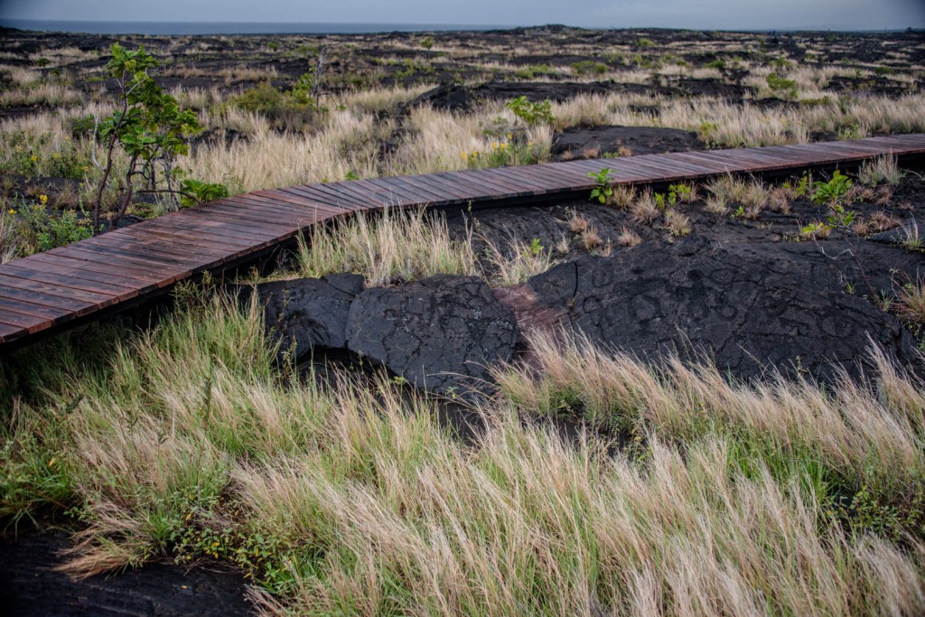

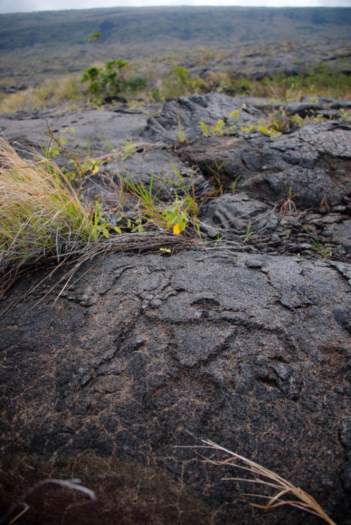
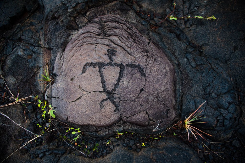
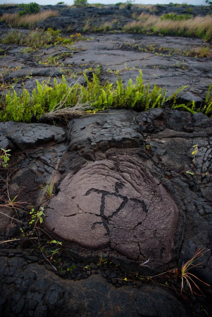
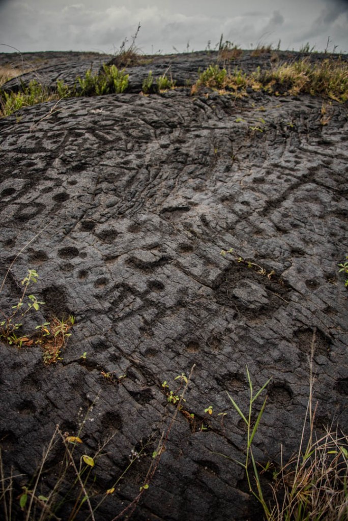
“Pukas,” also known as cupules, make up 85% of the 23,000 petroglyphs at the site. These appear like little dots or grinding holes in which the umbilical cords of newborns were placed for long life. There were bunches of them, representing what I imagine to be families and generations upon generations who would return to their specific region to celebrate their newest addition to the family. The views from the boardwalk are really nice, but we had so much fun just exploring afterwards. It was like once we noticed them and knew what to look for, we saw them for as far as the eye could see.
As the sun began to set, we made it to the end of the road. Somehow we managed to skip the rain during our outing, but the seas were quite rough near the sea arch. Parking is very limited.
We continued walking down the gravel fire road that had once been the continuation of the Chain of Craters Road before it got covered with lava. The rangers had told us that we could start here, walk a few miles down the gravel road and then walk up the hill to try to find the lava. But it would involve about a 14-16 mile round trip hike on uneven and unstable rock. Plus, as you can imagine the lava is the best to see around sunset as you see it more vibrantly as it gets dark. Walking back in the dark over the sharp lava rocks is why the rangers recommend bringing a real flashlight (not one from your cell phone), and sturdy footwear. We walked down the road a little bit and just marveled at the lava spilling out of the hillside from afar.
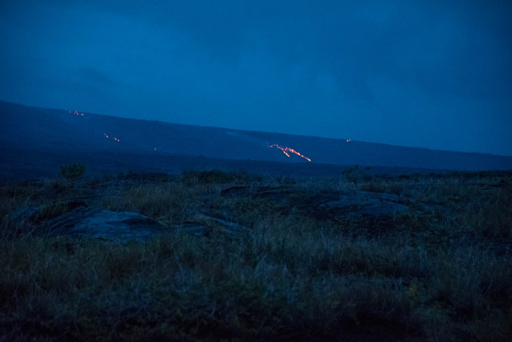
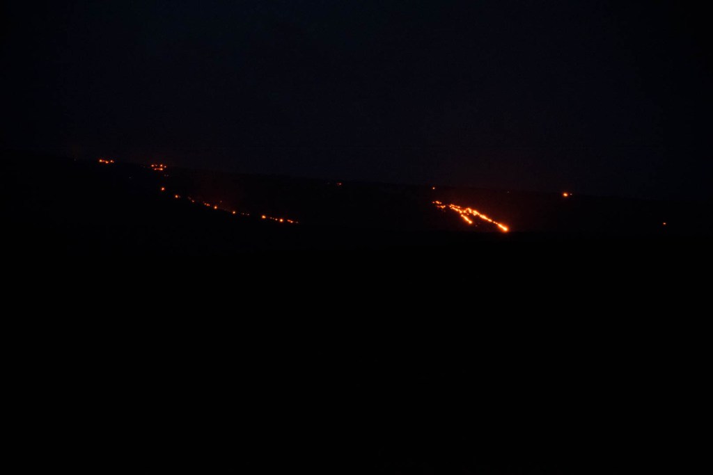
Just seeing that orange glow gave me a surge in adrenaline. We had thought about trying to hike up to the lava from outside of the park boundary. But we just didn’t get around to it. It remains on my bucket list for now, and I feel like I have only scratched the surface when it comes to exploring the park.
